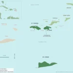
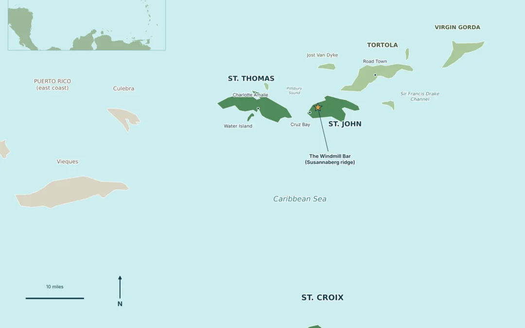
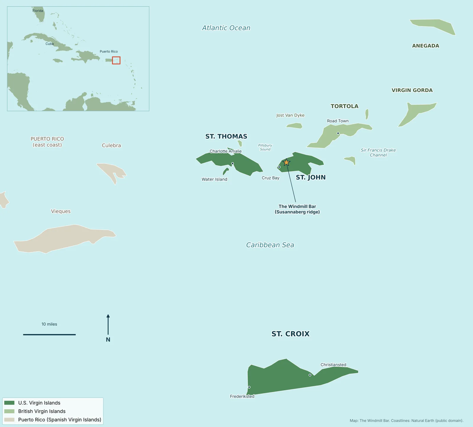
A Virgin Islands map shows roughly 90 islands, cays and rocks scattered across the line where the Atlantic Ocean meets the Caribbean Sea, about 40 miles east of Puerto Rico. The map splits into two territories: the U.S. Virgin Islands (St. Thomas, St. John, St. Croix and Water Island) and the British Virgin Islands (Tortola, Virgin Gorda, Jost Van Dyke and Anegada). Below is a clear map we made, plus the distances, ferry routes and island-by-island notes you actually need to plan a trip.
Virgin Islands Map at a Glance
If you only have 30 seconds, here is what the Virgin Islands map is telling you:
- Where they are: in the northeastern Caribbean, about 40 miles east of Puerto Rico, at the top of the Lesser Antilles chain.
- How many islands: about 90 islands, islets, cays and rocks in the whole group, according to Britannica.
- Two flags, one chain: the U.S. side has three larger islands plus Water Island and roughly 50 smaller cays. The British side has four larger islands and 32 smaller ones.
- The odd one out: St. Croix sits about 40 miles south of St. Thomas and St. John, on its own in the Caribbean Sea.
- The gateway: almost every trip starts at Cyril E. King Airport (STT) on St. Thomas.
- Total U.S. land area: 133.73 square miles, per the University of the Virgin Islands.
Where the Virgin Islands Are on a Caribbean Map
Zoom out on any Caribbean map and the Virgin Islands sit right at the corner where the big islands of the Greater Antilles (Cuba, Hispaniola, Puerto Rico) hand off to the small arc of the Lesser Antilles that curves south toward South America. That is why the inset on our Virgin Islands map has a red box just east of Puerto Rico.
A few practical things come with that location:
- Flying time: about 2.5 hours from Miami, per the University of the Virgin Islands.
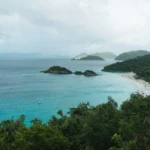
- Two coastlines: the north shores face the Atlantic and the south shores face the Caribbean Sea. On St. John that is why the north shore beaches like Trunk Bay and Cinnamon Bay can look calmer or rougher than the south side on the same day, depending on the swell.
- Time zone: Atlantic Standard Time all year, with no daylight saving time. In winter you are one hour ahead of New York. In summer you match it.
US Virgin Islands Map: The Four Main Islands
The dark green islands on the Virgin Islands map are American territory. US citizens can fly in without a passport, the dollar is the currency, and the mail is US Postal Service. Here is how they compare. For a deeper look at each one, see our guide to what islands are in the US Virgin Islands.
| Island | Size | Highest point | Where it sits on the map |
|---|---|---|---|
| St. Croix | 82 sq mi (largest) | Mount Eagle, 1,088 ft | About 40 miles south of St. Thomas |
| St. Thomas | 31 sq mi | Crown Mountain, about 1,550 ft | Western end of the northern chain |
| St. John | About 7 by 3 miles (roughly 12,500 acres) | Bordeaux Mountain, 1,277 ft | About 4 miles off St. Thomas’s East End |
| Water Island | Under 500 acres | About 300 ft | About half a mile off St. Thomas’s south shore |
St. Thomas
St. Thomas is the busy hub. Charlotte Amalie, the territorial capital, wraps around the harbor on the south side, and the airport sits just west of town. Red Hook, on the far East End, is where most St. John ferries leave from. On a map, think of St. Thomas as the launch pad for everything else.
St. John
St. John is the small, steep, green island just east of St. Thomas across Pillsbury Sound. The National Park Service says Virgin Islands National Park covers 7,259 acres, about 56.7% of the island, which is why so much of the St. John map is shaded park land. Cruz Bay is the main town and ferry dock on the west end, Coral Bay is the quieter harbor on the east end, and Centerline Road (Route 10) runs along the spine between them. Our St. John Virgin Islands guide covers the whole island.
St. Croix
St. Croix is the biggest island and the one people forget is part of the group, because it sits so far south on the Virgin Islands map. It has two historic towns, Christiansted on the north shore and Frederiksted on the west end, and a flatter, more open landscape than St. Thomas or St. John.
Water Island
Water Island is the fourth and smallest of the main US islands, tucked just south of Charlotte Amalie harbor. It is mostly residential and quiet, reached by a short ferry from Crown Bay on St. Thomas.
British Virgin Islands on the Map
The light green islands to the east are the British Virgin Islands, an overseas territory of the United Kingdom. They are close enough that you can see Tortola and Jost Van Dyke from St. John’s north shore on a clear day.
- Tortola is the largest BVI island and home to Road Town, the capital. Sage Mountain on Tortola, at 1,710 feet, is the highest point in the whole Virgin Islands chain, per Britannica.
- Virgin Gorda is east of Tortola and famous for the giant granite boulders at The Baths.
- Jost Van Dyke is the small island just north of St. John, known for its beach bars and sailboat anchorages.
- Anegada is the far northeastern outlier. It is the only flat island in the group, never more than 10 to 15 feet above sea level.
The stretch of water between Tortola and the islands south of it is the Sir Francis Drake Channel, one of the most popular sailing routes in the Caribbean. One important note: the BVI is a foreign country for US travelers, so you need a passport to cross over even though it looks like next door on the map. Our post on traveling to the USVI without a passport explains where that line falls.
The Spanish Virgin Islands
On the western edge of a full Virgin Islands map you will see Culebra and Vieques. Geographically they belong to the same island chain, but politically they are part of Puerto Rico, so you will often see them labeled the Spanish Virgin Islands or the Passage Islands. They are shaded tan on our map to keep that clear.
How to Read a Virgin Islands Map When You Plan a Trip
The distances look tiny on a Virgin Islands map, and they are, but every hop between islands means a boat. Here is how the main routes line up:
| Route | How you get there | Good to know |
|---|---|---|
| St. Thomas airport to St. John | Taxi to Red Hook or Crown Bay, then the ferry to Cruz Bay | There is no airport on St. John |
| Red Hook (St. Thomas) to Cruz Bay (St. John) | Passenger ferry across Pillsbury Sound | Ferries run every hour on the hour |
| St. Thomas to Water Island | Short ferry from Crown Bay | About half a mile of water |
| St. Thomas to St. Croix | Short flight or seaplane | About 40 miles of open water |
| St. John or St. Thomas to the BVI | International ferry | Passport required, plus customs |
A few map-reading tips from the island:
- Miles are not minutes. St. John is only about 7 miles long, but the roads climb and switch back constantly. Plan for slow, steep driving, not highway speeds.
- Drive on the left. Everywhere in the US Virgin Islands, traffic keeps left, even though most rental cars are left-hand drive.
- Download offline maps. Cell signal comes and goes in the valleys and on the north shore, so save the island to your phone before you leave Cruz Bay.
- Use the park’s own maps for beaches and trails. The National Park Service posts official Virgin Islands National Park maps, including a marine visitor use map, which is the best source for moorings and snorkel spots.
A St. John Map Cheat Sheet
Since we live on St. John, here is how the places people ask about most line up on the island, west to east:
- Cruz Bay on the west end: ferry dock, shops, restaurants and the start of Centerline Road and the North Shore Road.
- The Windmill Bar at Neptune’s Lookout in Susannaberg, two miles up Centerline Road from Cruz Bay, on the ridge with views down over the bays.
- The north shore beaches strung along North Shore Road: Trunk Bay, Cinnamon Bay and the bays beyond, almost all inside the national park.
- Bordeaux Mountain in the middle-east of the island, the highest point at 1,277 feet.
- Coral Bay on the east end: a laid-back harbor town and the jumping-off point for the quieter East End.

More Virgin Islands Map Resources
If you want a printable or more detailed Virgin Islands map, these are the sources we trust:
- National Park Service: official park maps for St. John’s beaches, trails and moorings.
- USGS: a public domain map of Puerto Rico and the Virgin Islands, handy for the big-picture view.
- Our map above: feel free to save it for your trip planning. It is built from public domain Natural Earth coastline data.
Virgin Islands Map FAQ
Where are the Virgin Islands on the map?
They are in the northeastern Caribbean, about 40 miles east of Puerto Rico, between the Atlantic Ocean to the north and the Caribbean Sea to the south.
How many islands are in the Virgin Islands?
About 90 islands, islets, cays and rocks in total. The US side has four main islands (St. Thomas, St. John, St. Croix and Water Island) and the British side has four larger islands (Tortola, Virgin Gorda, Jost Van Dyke and Anegada).
Which is closer to St. John, St. Thomas or Tortola?
Both are close. St. John sits about 4 miles off St. Thomas’s East End, and Tortola is just across the water to the northeast. The difference is the border: St. Thomas is a domestic ferry ride, while Tortola means a passport and customs.
Why is St. Croix so far from the other Virgin Islands?
St. Croix sits on its own across about 40 miles of deep water south of St. Thomas and St. John, so on a Virgin Islands map it looks separate from the main cluster. It is still part of the US Virgin Islands.
Can you see other islands from St. John?
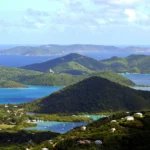
Yes. From high spots on St. John you can see St. Thomas to the west and the British Virgin Islands to the north and east on a clear day. The ridge at Susannaberg, where The Windmill Bar sits, is one of the easiest places to take it all in.
Come See the Map From Up Here
Once you have the Virgin Islands map figured out, come see it for real. The Windmill Bar sits on the ridge at Neptune’s Lookout, two miles up Centerline Road from the Cruz Bay ferry dock, and we are open daily from 11am to 8pm. Grab a drink, look out over the bays and pick out the islands you just read about. Get directions to The Windmill Bar, peek at the view right now on our live cam, or check the menu before you head up.